
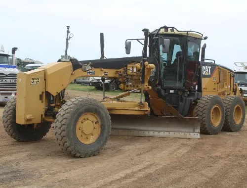
GPS Site Design Checklist
GPS Site Design Checklist
Across Dean Park, Blacktown, Liverpool, Parramatta, Menangle and the wider Sydney market, project teams are relying more on model-based planning, tighter tolerances and faster site coordination. That trend fits the growth happening across Western Sydney, where the Western Sydney Employment Area and Aerotropolis planning continue to support future jobs, roads and development activity.
Why GPS readiness matters
GPS machine control is not just a switch you turn on at the start of the day. It depends on the quality of the information behind it.
Trimble explains that machine control systems use GPS and sensors to guide heavy equipment, while 3D machine control relies on GPS together with a digital site model for complex contours and site-wide accuracy. The same source notes that these systems can improve accuracy and productivity while reducing errors and operator guesswork.
That is why a proper GPS site design checklist matters. When the design, levels and site information are ready before booking, the work can move forward with more confidence. When they are not ready, even experienced teams can lose time sorting out preventable issues on day one.
Start with an approved design, not an idea
The first question is simple: do you have a final design that is ready to be used in the field?
For GPS-supported work, a verbal description or a rough concept is not enough. The design needs to be clear, coordinated and suitable for site use. Transport for NSW’s standards specifically reference the use of a design model within a machine guidance system, and its digital engineering guidance is built around structured project information and consistent spatial data delivery.
In practical terms, that means the customer should already have the design prepared before asking for GPS-based work. If the design is still changing every few hours, the site is not truly GPS-ready yet.
Confirm the file handover early
One of the most common slowdowns on digital jobs is leaving the file handover too late.
Before the booking is confirmed, make sure the right files can be supplied and that the people involved know which version is current. That includes surfaces, linework, set-out references and any supporting information needed to interpret the design properly. A machine can only follow the data it is given, so confusion around file versions creates risk straight away.
This is where good project teams stand out. They do not assume that “the design is somewhere in an email.” They identify the correct file, confirm it is the latest revision and make sure it can actually be used on site.
Check levels, datum and control
A GPS-ready project is not only about the shape of the design. It is also about making sure the design matches the site’s control information.
If levels, datum, boundaries or control points are unclear, the job can drift into avoidable rechecking and delay. Industry guidance on 3D model-based construction consistently treats survey control as the link between the design model and real field conditions, because that is what allows the digital surface to be placed correctly on the ground.
For project managers, the lesson is straightforward: confirm the reference framework before the start date. It is much easier to solve a control question in the planning stage than while the machine is already waiting on site.
Be clear about extents and tie-ins
Many GPS delays happen because the design says what the finished surface should be, but not clearly enough where it starts, where it stops or what it ties into.
Before work begins, confirm:
- the exact work area
- the intended finish level or grade
- the tie-in points to existing ground or structures
- any exclusion zones
- whether the work is rough shaping, trimming or a finished surface requirement
This is especially important on subdivisions, road-related projects and industrial pads, where one missing detail can affect the next crew. GPS helps accuracy, but it does not replace scope clarity.
Keep survey, design and site teams aligned
A strong GPS job usually has one thing in common: the survey, design and site teams are talking to each other before the start.
That does not mean endless meetings. It means the essentials are resolved early. Who owns the latest model? Who signs off revisions? Who answers a level query? Who confirms whether an older file should be ignored? Transport for NSW’s digital engineering framework is built around collaborative information management for precisely this reason: construction works better when project data is consistent and shared properly across disciplines.
When those lines of communication are weak, GPS becomes harder than it should be. When they are strong, the work tends to run cleaner and faster.
Review site conditions, not just digital files
A project can be digitally ready and still not be physically ready.
Even with GPS, the actual site still matters. Access, traffic around the work zone, wet ground, obstructions and staging all affect how efficiently the work can proceed. A model may show the target finish, but it cannot fix poor access or unsuitable ground conditions on the day.
That is why GPS preparation should include a real-world site check:
- Is the access route clear?
- Is the working area firm enough?
- Are there heavy grass areas or obstacles to be cleared first?
- Is there enough room to work safely and continuously?
- Has recent rain changed the plan?
Good digital preparation and good site preparation need to work together.
Plan for revisions before the start date
Revisions are normal on larger projects. Problems start when nobody controls them.
If the design changes, everyone involved should know which revision is current and when it takes effect. A common mistake is to assume a new file has been issued clearly, when in reality different people are working from different versions. On a GPS-supported job, that can quickly lead to confusion, rework or a pause while details are checked.
A better approach is to nominate one current revision, one point of contact and one clear handover process. It sounds simple because it is simple, and that simplicity protects the project.
What to have ready before you enquire
A more useful first phone call usually happens when these details are ready:
- site suburb and access notes
- type of work required
- expected start date
- estimated hours
- whether GPS is needed
- whether the customer-supplied design is already prepared
- any special notes about levels, tie-ins or finish expectations
That makes it easier to discuss suitability, availability and the next step without wasting time on guesswork.
Better preparation leads to better results
GPS-supported work delivers the most value when the project team is organised before the booking, not after arrival on site.
Winning Edge Enterprises Pty Ltd works with larger farm, civil and industrial projects across Sydney and surrounding suburbs, including jobs where GPS is required and the customer provides the design. If you want a practical discussion about site suitability, availability and what needs to be ready before work begins, contact Winning Edge Enterprises Pty Ltd and submit your enquiry.